In Istanbul, the closer you come to the western edge of the metropolitan area, the more Asian-like it gets. This is where size matters—and density, too. This excursion is meant to help participants comprehend the mechanisms of where, when, and how the 16 million Istanbulites were packed together.
The tour follows the waves of industrialization, deindustrialization, and reindustrialization: Istanbul expelled industrial production from its historical core while simultaneously relocating it to its own active fringes. We will read this process through the dynamically transforming patterns of housing areas. We will follow successive parallel valleys extending westbound into the agricultural zone in Thrace, as well as successive layers of urbanization extending northbound following highway constructions into the fragile metropolitan ecozone toward the Black Sea. This grid of valleys and layers functions as a basic textbook of housing patterns and actors. Institutions of formal mass housing development, as well as phases of informal and post-informal housing production, will appear in a chronological and systemic narrative.
1. Former Working Class Residential Areas at the Industrial Zone Topkapı in Transition: Cuba, Tozkoparan
Just outside the city walls an industrial zone emerged from the 1950s onward and triggered working-class settlements in its vicinity. Since the 1990s, this centrally located area has been undergoing a post-industrial transformation. One of the last relics of the original gecekondu belt is still visible close to the first highway ring. The inhabitants, in resistance to forced state-and-market-driven transformation, self-assigned the name Küba to their settlement. The adjacent Tozkoparan is one of the rare (about 50 compounds in all of Istanbul) Gecekondu Prevention Areas—i.e. formal working-class residential projects realized directly by the Ministry of Public Works in the 1960s. This modernist settlement with approximately 3,000 units has been demolished very recently; the last units are disappearing right now. The recent transformation under a PPP model is driven by the Güngören district municipality, enabled by the new-TOKI regime (see below, 5).
2. Ataköy, the Middle Class New Town
The first modern mass housing project after WWII was realized by the state-owned Emlak (Real Estate) Bank and comprises 11 sectors with 80,000 inhabitants. The institution was originally founded in the 1930s to solve the housing problem of Ankara, the fast-growing new national capital. Ataköy, one of their three initial Istanbul projects, was placed along the Marmara coastal express road and served the housing needs of the motorized middle and upper-middle classes, who desired to escape the inner districts with their narrow roads. We will stop at Sector I, with its praised settlement pattern and modernist architectural solutions, and drive through later (2-11) sectors of Ataköy; 21st-century additions are developed no longer as sectors but as enclosed “PPP-projects,” mainly on the waterfront.
3. Halkalı Sub-town / Working Class
In the mid-1980s, the production of formal mass housing for the working class inevitably came onto the agenda. TOKI, the Mass Housing Administration, was founded and began playing a pivotal role in resculpting Istanbul into its new macroform alongside the new east–west highway network, with formally separated zones for living and production. We will stop at Sector I of Halkalı (total 200,000 inhabitants in all sectors), with its elaborate architectural solutions, and take a break at Arena Mall, an open-air structure at the interface of formal and informal development areas. Commercial infrastructures are often used to create public space. We drive through later sectors, with dystopian character devoid of any urbanity, to finally arrive in the recently built section with branded living compounds. In The Bosphorus City and Palaces of Istanbul, the developer sincerely meant to copy-paste the metropolis itself. The result: a must-see. In the adjacent Lounge Istanbul, an honest architect tried to escape the dictated persiflage. Tema Istanbul, the originally most ambitious project of this episode simply derailed and became a mediocre giant.
4. The Second Wave of Informality
Altınşehir and Şahintepe are two vast areas of “late informality under market conditions” (not: gecekondu). They are tightly enclosed by formally developed zones surrounding the second highway ring. The course of Kanal Istanbul—that phantom mega-project—will allegedly run between the two; the Olympic Stadium is just next door.
Altınşehir is currently being formalized with a small-capital transformation model; Şahintepe, however, is on a different course: that of resistance. Our stopovers in this section will include: (a) an informal “campus” for recycling construction material, (b) the neighborhood association in Şahintepe, and (c) a viewpoint upon the Sazlıdere Valley, which should become the course of Kanal Istanbul.
5. The Emergence of the Current Regime for Mainstream Mass Housing, by way of Emlak/TOKI Fusion
In the 1990s, Emlak Bank was assigned the new-generation housing project Bahçeşehir (“The Garden City”) at the second highway, while work in Ataköy continued. That decade of Emlak became one of utmost corruption, involving politicians, administration, and private actors; the bank had to be dissolved, and its assets, projects, and corporate culture were transferred to TOKI. During the 21st century, a distinctive regime of capital accumulation under state capitalism was established using this new Mass Housing Administration. We will allow ourselves only short photo stops while passing through ever-expanding Ispartakule and Bahçeşehir newtowns.
6. Citizens Correct Academic Planning
Boğazköy is a neighborhood of working-class cooperatives, between white collar Bahçeşehir to its south and the Hadımköy industrial area in the north. Morphologically, it is a textbook example of Blockrandbebauung (perimeter block development) with green inner courtyards. However, almost two decades after the completion of construction works, it was still a ghost town. The owners took affairs into their own hands and corrected the grand planning fault: Boğazköy became a very livable area. A stroll down the main street.
7. Esenyurt, the Powerhouse of Istanbul
On the way back, we will allow ourselves a last stopover at the main square of Esenyurt, the largest of Istanbul’s 39 districts, with over one million inhabitants. Esenyurt, where urbanization began in the mid-1980s, is today the powerhouse of Istanbul, bearing the major load of industrial production, its harbor, and its power plant. The political history of this highly contested district reads like a crime novel, while the cityscape reflects waves of unchained developmentalism from a society entirely of migratory background.

“Cuba, our homeland” Graffiti, Küba mahallesi. source https://www.yenicaggazetesi.com/gazeteci-ismail-saymaz-kuba-mahallesinin-son-halini-paylasti-562576h.htm
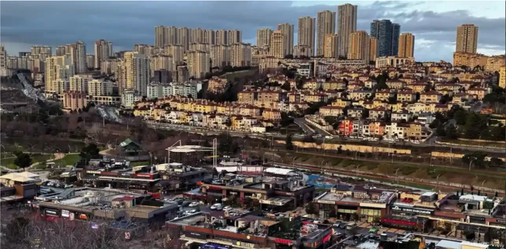
Bahçeşehir, “The Garden City”, contested illegal foodcourt development ontop the settlements’ lakeside park
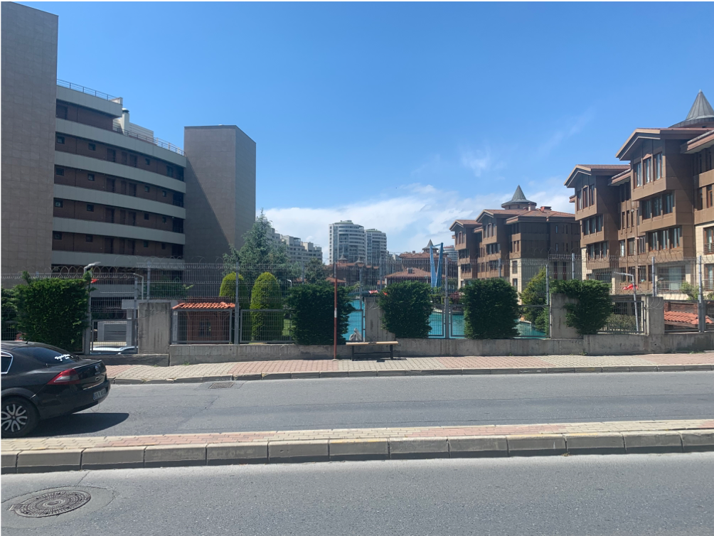
Istanbul, as copy pasted into its own Westend. Photo Orhan Esen
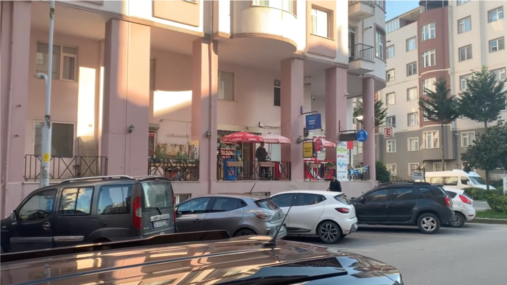
Boğazköy, Citizen based post-planning. Photo Orhan Esen

@Şahintepe People’s Solidarity Association. Photo Orhan Esen
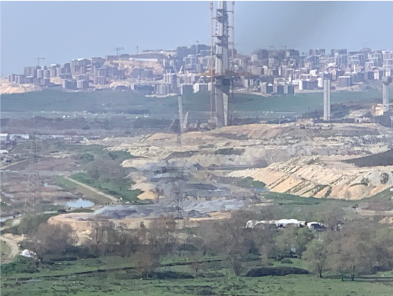
Southern end of the Sazlıdere (or “Reed creek”) valley, water protection area being demolished. Course of the Phantom Kanal Istanbul. Photo Orhan Esen
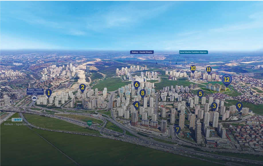
Ispartakule “Towers of Sparta” development area, between the Garden City (left)and informal Şahintepe “Falcons’ Hill” (right), between lake Küçükçekmece and Northern Forestbelt
source: https://www.insaatyatirim.com/Haber/49799/ihlas-gayrimenkul-un-ispartakule-deki-yeni-projesi-bizim-evler-12-satisa-cikti

@ Campus for circular construction economy, Altınşehir “Goldentown”, Photo Onur Ceritoğlu

https://www.google.com/maps/d/u/0/viewer?ll=41.02960552113402%2C28.770943665347012&z=12&mid=1Ai45AayL-QN0ly7eRA3GDSRCP_8qfjA